Saturday, 27 April 2013

Lucerne: Renggpass, glass maze, and a tick for your trouble

I stayed an extra night in Zurich to see some of the surrounds but had a tough time deciding what I could do in a day.  The mountains beckoned since I wanted to do something kid-unfriendly while I was kid free, but it they were a fair distance away and the weather was going to be terrible.  The weather also counted out a bunch of other stuff I was considering like going up Mt. Pilatus near Lucerne (there's a cool toboggan track there but I was a couple of weeks too early for it to be open, although the ropes course was open), and going paragliding. I eventually decided to do a mountain bike ride over the Renggpass near Hergiswil that I saw on myswitzerland.com.

It sounded pretty cool:
Like an enormous wedge, the Lopper mountain chain separates the main basin of Lake Constance from Alpnachersee. Before the road and railway were cut into the vertical rock walls, Rengpass was the only link between Lucerne and Obwalden. Today, the pass has become one of the most popular bike loops of central Switzerland.
And looked amazing:


Unfortunately when I got to that point the view looked like this:


I downloaded the GPS track from the surprisingly helpful myswitzerland site, stuck it on maps and printed it out.


View Renggpass Ride, Hergiswil, Switzerland in a larger map

I reserved a bike from the Swiss Rent-a-bike site, which is a fantastic service.  You can rent a variety of bikes (anything from an electric bike to a full suspension mountain bike) at most major train stations in Switzerland.  You reserve online then pick it up at the Luggage window at the train station (at Zurich HB this is on the outside of the terminal on the Mueuemstrasse side, follow the suitcase icons).  The rental gets you free travel for the bike on all trains (you usually need to buy a discounted bike ticket), and you can even drop it off at a different train station.  It was short notice (reserved the night before) so I had to settle for a hard-tail, but hey.

Lady at Zurich HB: "Not so nice day for biking."
Me: "Yeah, I'm going anyway"

I got the train from Zurich to Lucerne and got a stern talking to from a Swiss train conductor because I had my bike in the wrong place (they have a designated bike car for bikes and strollers on basically every train).  Then another train to Hergiswil (bike in the right place this time).  I was hoping for storage lockers at Hergiswil train station, but no such luck, so I lugged a change of clothes and other assorted crap like my kindle around the whole ride in my laptop bag, which was less than ideal...but "I'm going anyway".

Hergiswil station, Renggpass looming in the clouds off to the left
Even with the printed map and some spotty phone GPS signal I had some trouble finding the trail and tramped around a few farms expecting to be yelled at by a Swiss farmer at any moment.  Chickens, cows, and goats abounded.  The view was great until I got into the clouds, and the road was super steep.


Is this really the path?  It really was.  That's someone's farmhouse on the left.  I imagine this is the equivalent of  an old 'right of way' in England.

Goodbye visibility


Aha! I'm going the right way


Holy crapballs these rocks are slick, I really should have told someone where I was going...


The last section would make a good black diamond ski run.  No way I was riding down here.  In fact I did rather a lot of  pushing the bike around...


The end of the ride. That red sign has a bike on it, which is interesting since it's in the middle of about 4 flights of stairs....
Afterwards I scraped most of the mud and sticks off my shoes in the toilet of a cafe full of old people having a glass of wine after visiting the Hergiswil glass works and changed back into my regular clothes.  As I stepped in all sweaty and soaked from the rain they all looked at me like "who is this guy"?

The glassworks is actually pretty cool, I did a quick trip through the museum before getting into the glass maze: a dark room with a disorienting lightshow and a maze made out of lots of glass panels.  They give you gloves and slippers for your shoes to stop you leaving marks on the glass.

Hergiswil glass maze
And on the way back through Lucerne I did a quick bike around a couple of sights before heading back to Zurich.

There was a giant crowd at the Lucerne train station which seemed to be the finish line for some sort of running race.

Kapellbrücke (The Chapel Bridge), the oldest wooden covered bridge in Europe
The Löwendenkmal (The Lion Monument).  Looked cooler than it sounded in the guidebook, but I had to fight my way through a busload of tourists to see it.
Some hours later I discovered I'd brought back a little souvenir from the ride.  My ankle was about the only thing exposed :(  This got me nervous about Lyme disease and other nasties.  If you go into the woods in Switzerland you probably want repellent and if you're going to do it a lot, the TBEV vaccine.  As a colleague of mine said: "Trust the Australian to find the only dangerous thing in Switzerland".

Tick buried in my ankle

Friday, 26 April 2013

Zurich

Quick trip to Zurich for work, and I was very impressed. Beautiful city with a stunning mountain backdrop, fantastic public transport (Lonely plant says "possibly the densest public transport system in the world"), with tons of restaurants and bars (2000+ apparently, which is pretty amazing for a town of 390k). According to LP it is often voted Europe's most livable city.

I stayed at the B2, which was excellent. It even has a giant rooftop spa. I went up on a cold evening and lay back in bubbles while looking over the rooftops of Zurich, which was pretty nice. I did feel slightly out of place without my significant other though, I was probably the only single guy with about 30 couples up there.

B2 Boutique hotel: Amazing dining/breakfast room with floor to (very high) ceiling books

On my first afternoon I went for a run out towards Uetliberg in an attempt to stay awake and beat the jet lag. The staying awake worked, but was still jet-lagged :(


The first few days were rainy and cool, but then I got a beautiful 24°C Friday afternoon, and since I'd been working crazy long hours due to jet lag I left work a little early and walked around to the lawns in front of the Chinese Gardens.

It was a great vibe, people were BBQ'ing Bratwurst on mini grills, playing music, and even slacklining.  I picked up a beer and a Bratwurst from a street stall and kicked back for a few hours to read my book and watch the sunset.


The combination of super-expensive food, long hours and free food at work meant I ate most of my meals at work, but I did have a great team dinner at Didi's and a giant calzone (which with a small green salad and a beer was something like $US45, ouch) in downtown Zurich.

Chocolate art @ Didi's

Saturday, 9 February 2013

Is that a snowmobile track on the roof?

A year later, and it was time to return to Tahoe for a very similar trip (ski heavenly, stay at Harrah's), but with much better snow conditions than last year. Unfortunately the Sky Express was closed due to wind, so I worked on improving my mogul skiing on Little Dipper and in Aries Woods off the Comet express. I got a lot better at riding bumps and dodging trees by the end of the day.


Nevada desert on the right

It was pretty cold in the wind, and some heavy snow dropped visibility to basically zero, so I was grateful for the bank-robber-style facemask and chemical handwarmers that helped me keep skiing until the lifts closed around 4pm.

On the second day I jumped on a snowmobile for a 2 hour tour in Hope valley with Lake Tahoe Adventures.  It was heaps of fun.  We were kitted out in super-warm 80s fluro onesies, thick boots and helmets, and rode an Arctic Cat sled each.  Really easy to operate, just turn the key and squeeze the throttle.  We covered about 30 miles of snow covered roads and trails through some great Sierra scenery.  Our top speed was around 35 mph (56 kph), but most of the time we were going probably half that speed.  No crazy jumps, steep descents, or forays into the powder for us beginners :)


Hopping on our sleds, they had heaps available, no man-hugging necessary

These buildings and surrounds apparently featured in Stephen King's movie 'Misery'.  Note the sled track on the roof (it wasn't us).  According to our guide, every major car manufacturer in the world has visited to shoot 4WD scenes in this area at various stages.


I have to admit to feeling sorry for the lone snowshoe hiker we encountered, who then had 30 noisy snow mobiles blast past them.  I've been on the other end of that equation.  If there was a super-silent snow mobile it would be the perfect way to explore alpine backcountry.

Sunday, 3 February 2013

Glacier Point: Yosemite in Winter

A friend from Australia mentioned he was interested in doing some snow hiking in Yosemite, and I soon talked him into doing the ski trip I'd been eyeing off for a while: Badger Pass to Glacier Point, inspired by this blog post.

We did some quick planning, bought food, and hired first a 4WD, then XC skis, boots, and poles at Sports Basement in Sunnyvale on Friday night.  This was super-slow and they had little choice of gear, but at least it meant we were ready to go the next day.  A 4:30AM start got us to Badger Pass at around 10:30AM with breakfast and last-minute food shopping (sandwiches for lunch) in Mariposa on the way.  The 4WD was necessary to fit the skis inside, but we didn't need it for the road: it was ploughed and there were plenty of 2WDs in the Badger Pass carpark.

While in the backcountry office at Badger Pass there was a nervous moment when the ranger asked if we'd thought about food storage, because we'd read that a bear barrel was required in Yosemite year-round...and we didn't have one.  But apparently bear hangs are fine from December to March in the backcountry, and we were ready for that.  We asked the ranger if he'd seen any bears and he said 'tracks but no scat'.

Armed with a backcountry permit we set off around 11AM, and made sure we fell over immediately after we put on our skis.  Getting the balance right with a full overnight pack was a little tricky, but we got the hang of it soon enough.  The road was groomed and fairly icy in parts so it wasn't the softest landing surface.

Trailhead at Badger Pass
There were plenty of day trippers skiing along the road, some going as far as Glacier Point and back in a day - much better skiers than us.  There are also a bunch of other ski and snowshoe trails off the Glacier Point road.

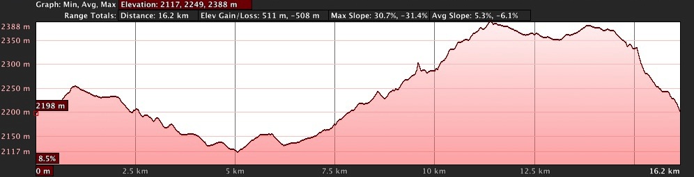
It's 10.5 miles (16.9 km) one-way along the Glacier Point road.  The terrain is fairly flat, tending towards downhill for the first few km, before starting a long sustained climb up to shortly before Glacier Point, when it turns to a steep series of downhill switchbacks, leaving you at basically the same altitude that you started with.


There is a cosy hut that you can pay to stay in, that includes dinner and even sleeping bags if you want them, but we were tough and carried all our gear for snow camping.  Not that we had the option to stay in the hut, Saturday nights were booked out months in advance (some people we spoke to booked in November) and I was probably never going to be that organised :)  It looked like there were bunk beds for about 10 people.

Lunch at Clark View
Icicles at Clark View
Typical view of the trail


Beginning the steep-ish descent to Glacier Point

Fantastic view from Washburn Point. Half Dome looking a lot more slopey than it does from the valley floor.
View from Washburn Point.  From left: North Dome, Basket Dome, Half Dome,  Mount Broderick, Liberty Cap, Vernal and Nevada Falls
An even more fantastic view from Glacier Point.  Clouds Rest visible just to the left of Half Dome.

The hut at Glacier Point
We got to Glacier Point around 3:30PM and spent a long time marvelling at the view.  You could easily hear Vernal and Nevada falls hitting rocks hundreds of metres lower and across the valley.  We walked the requisite few hundred metres away from the hut and set up camp on the western side of the hut, sheltered from the wind, and in great position for a sunset view.

Our snow camp at sunset
Saturday had been fairly overcast, but not particularly cold.  Overnight temperature was just below freezing, and we were toasty in our tent.  The next day was quite warm, and we skied in T-shirts for most of the day.

View from Glacier point the next morning in brilliant sunshine, the shadow of Half Dome hitting North Dome

Upper and Lower Yosemite Falls from Glacier Point
The climb up from Glacier Point was hard work, we ended up taking our skis off and walking, which enabled us to slightly beat the people who skied up.  After that we had a great downhill run past Clark View and gradual uphill for most of the rest of the way.  It took us almost an identical amount of time to ski back to Badger Pass.

Badger Pass ski area carpark